Walks & Parks
-

Curio Bay - Catlins
Curio Bay is of international significance for its fossilised forest dating back to the Jurassic period. The tree fossils you see here are 160 million years old and the forest was alive when NZ was part of Gondwanaland. Curio Bay’s fossil forest is best viewed at low tide from the viewing platform which is only a short walk (5 minutes) from the car park.
read more -

Labyrinth Rocks Walkway
Just two kilometres out of Takaka, on the way to Pohara, are three big oak trees. Turn left here, follow the signs to Labyrinth Rocks Walkway and you will find one of Golden Bay's most amazing places. Nature has produced a maze-like network of canyons through a limestone outcrop " an excellent example of the geological term 'Karst' limestone for which this area is known. It has been developed (and is still in the process of being developed) as an enchanting family attraction. Young or old, you will love exploring all the nooks and crannies - keep younger kids close to you as you can get lost in the maze, older kids will enjoy going off and trying to find their way back. A magical thing to do - is see if you can find little toys and figurines hidden in the rocks - it's the locals kids secret toy swop. So if your child brings their own figure/toy (check out the Salvation Army shop in town), your child can find one they love they can take it and leave theirs in its place! They will be begging to go back the next day.
read more- Location: 7183, 45 Scott Rd, Takaka 7183
-

Speargrass Track Hut
For an easy overnight tramp, great for kids, walk to Speargrass Hut on this well graded track. 2 hr 30 min one way - this well graded track descends gradually from the carpark. It follows the river along the valley floor then climbs up through beautiful beech forest to Speargrass Hut ( 12 bunk beds) – set in clearing with mountain views.
read more- Location: Mt Robert Road, off SH 63 east of St Arnaud.
-

Abel Tasman National Park
New Zealand’s smallest National Park at just 225sq km. Both the inland and coastal tracks are famous for their outstanding beauty, and it’s very easy to take the family on small sections of the coastal track (total is 51km), walking for anything from an hour, half or full day. You can then arrange to pick up a water taxi back to Marahau or Kaiteriteri. The track starts at Marahau, just outside the Park Café. From here you walk along the boardwalks for about 5 minutes, to the start of the actual track. Short walk - the first section of the track is very easy and you can be picnicking on a secluded beach within 20 minutes, admiring the turquoise waters, golden sand and inquisitive birdlife. Other walking options - If you carry on to the first hut on the track, at Anchorage Bay, you’re in for a stunning walk but it’ll be 4 to 5 hours. Water taxis have a scheduled pick up from Anchorage to Marahau, and the last departure is around 3.30pm. Check this before you leave, or book a personalised pick up service. Water taxi cruise / walk – all water taxi companies also offer tours where you can be dropped off at a scenic section of the park and walk for a few hours before you are picked up again. See individual companies for more details.
read more -

Waterfall Track - Hamner
Climb through mountain beech forest to the spectacular 41 metre high Dog Stream Waterfall. The winding and moderately steep trail begins at the top of McIntyres Road (accessed off Jollies Pass Road) and heads up the stream edge through dense native forest. The walk is interesting and varied as it traverses the watershed just above the deep gutter of Dog Stream, (parents with young children need to take care at several places along this track), climbing up wooden stairways in the forest and sidling along small cliff faces to reach the rock face and small basin into which the waterfall plummets. A suggested round trip is to return via the Spur Track and Fir Trail.
read more- Location: McIntyres Road (accessed off Jollies Pass Road), Hamner
-

Pupu Hydro Walkway
Pupu Hydro Walkway (Loop 1 hr 50 min) begins 9 km from Takaka at the end of Pupu Valley Road. Follow the road towards Te Waikoropupū Springs, turning off to the right just before the bridge crossing Waikoropupū River. The Pupu Hydro Walkway retraces an old gold-mining water race, which has been reused for power generation. Botanically the walkway is very interesting, bird life is plentiful, and the history is fascinating. Although the climb to the water race line is a little steep, the first section, across Waikoropupū River to the power station, is an easy grade suitable for all ages. Beyond the power station the track crosses Campbell Creek and zigzags upwards to reach the race after about 30 minutes’ climb. From here the track levels out and follows the race ‘upstream’ for a short distance to a lookout point above the power station. From here on you are strongly advised to carry small children in a backpack and watch other children carefully; a fall from the race and the water itself are potentially dangerous. The water race, which follows the steep contours of the hillside and is part canal and part aqueduct, was an engineering masterpiece for its time. If you look carefully in the water you might see large kōura (freshwater crayfish). Follow the race for 30 minutes or so to the weir (the water intake), which marks the end of the walkway and is a beautiful picnic spot. The weir channels water from the creek into the race; a large shutter was raised or lowered to vary the amount of water taken from the stream. The Hydro Society 4WD vehicle access track from the weir makes the walkway a loop walk (50 min) back to the car park.
read more- Location: Pupu Valley Rd, Tasman Takaka
-

Paynes Ford Scenic Reserve
Paynes Ford Scenic Reserve is located along State Highway 60, 3 km south of Takaka. It takes its name from the original ford across the flood-prone Takaka River on the main road into Takaka. A modern bridge now replaces the ford. With its impressive line of limestone bluffs emerging from a remnant patch of forest, Paynes Ford is one of New Zealand’s best rock-climbing areas. Climbers come from far and wide to enjoy the challenge of the sheer rock faces — these are definitely not for beginners! Non-climbers will enjoy a visit to the reserve to picnic, swim, walk or watch the climbers. There is a large picnic area beside the highway bridge. At the southern end of this area is a toilet, where the Paynes Ford Tramline Track (a 30-minute walk) begins. The track provides access to the climbing areas and some excellent swimming holes in the Takaka River. It follows the line of a railway that operated between the early 1880s and 1905 and was used to take timber from the Takaka valley down to Waitapu wharf.
read more- Location: 1886 Takaka Valley Hwy, Takaka 7183
-
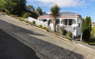
The World's Steepest Street
Baldwin Street, in Dunedin, is reputed to be the world's steepest street, with an average slope ratio of 1:5. It's steepest section has a gradient of 1:2.86 so for every 2.86 metres travelled horizontally, the elevation rises by one metre. The street is the venue for an annual event in Dunedin, the "Baldwin Street Gutbuster", every summer since 1988 (usually in February). This exercise in fitness and balance involves athletes running from the base of the street to the top and back down again. Since 2002, a further charity event has been held annually in July, which involves the rolling of over 30,000 Jaffas (spherical candy-coated chocolate sweets). Each jaffa is sponsored by one person, with prizes to the winner and funds raised going to charity.
read more -

Christchurch–Little River Railtrail
This biking/walking rail trail is a community project, which eventually plans to extend for 44 km between Christchurch and Little River. Two sections have been completed to date; f... read more
- Location: There are a number of entry points into the railtrail, accessed off the Christchurch to Akaroa highway.
North Island
South Island

- Central Otago
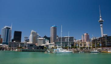
- Auckland
- Bay of Plenty
- Christchurch
- Dunedin
- Coromandel
- Gisborne
- Fiordland
- Hawkes Bay
- Marlborough Sounds
- Manawatu
- Nelson & Golden Bay
- Northland
- North Canterbury
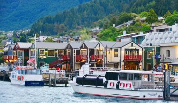
- Queenstown
- Rotorua
- South Canterbury
- Taranaki
- Southland
- Taupo
- Wanaka
- Waikato
- Wellington
- West Coast
- Whangarei
- Bay of Islands
- Tauranga
- Gisborne
- Hamilton
- Napier
- Kapiti
- Palmerston North
- Whanganui
- New Plymouth
- Arrowtown
- Te Anau
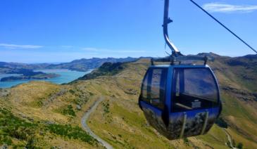
- Akaroa
- Ashburton
- Hanmer
- Kaikoura
- Methven
- Mt Cook
- Oamaru
- Tekapo
- Timaru
- Abel Tasman
- Motueka
- Nelson Lakes
- Blenheim
- Picton
- Catlins
- Gore
- Stewart Island
- Central Plateau
- Invercargill
- Cromwell
- Greymouth
- Hokitika
- Westport
- Glenorchy
Our favourite destinations…