Walks & Parks
-

Kaikoura Peninsula Walkway
The track crosses the peninsula’s clifftop, with excellent views of the Seaward Kaikoura Range, ocean and coastline, to South Bay. It returns to the township via South Bay and Toms Track. Potential to observe wildlife including seals and sea birds.
This family friendly walk can be done in parts or if you want to explore the entire walk allow 3 hours.
read more- Location: Kaikoura peninsula
-

Te Anau Lakefront Walk - Control Gates
A beautiful lakeside walk that takes you to the Lake te Anau Control Gates and the start of the famous Kepler Track. You walk past the Visitor Information Centre and through the grounds of Te Anau Wildlife Centre - this is the ideal setting to learn about some of Fiordland's wildlife. The centre offers the chance to see NZ native birds including the colourful and rare flightless Takahe. There is no entry fee but donations are appreciated. The path continues alongside the lake and is completely flat.
read more- Location: Te Anau - from towncentre lakefront, head to the left, keeping Lake Te Anau on your right.
-

Central Park Play Area
Located on the fringe of Wellington’s central business district, this park features a three cable flying fox, a six metre high space ball climbing frame, spinner bowl, whirl and swings. The park also has a junior section with slides, swings, crawl tunnels, climbing net and seesaws.
read more- Location: Brooklyn Road, Wellington
-

Hawkes Bay - White Pines Bush
29km north of Napier on SH2, native bush walk with educational panels, native birds and forest. The reserve has huge kahikatea, dwarfing the tawa and pukatea that provide most of the remaining tree cover. Nikau palms are also an attraction. Hanging vines, shrubs and ferns proliferate under the tree canopy, providing habitat for native birds including tui, kereru (native pigeons), fantails, bellbirds, silver-eyes, grey warblers and ruru (morepork). Boardwalks make it easy with buggies and there are two walks to choose from – 30 minutes or 1 hour. Toilets and picnic area.
read more- Location: SH2, 29km north of Napier
-

Whites Bay tracks
Whites Bay has walks for a range of abilities, including kids - there are rocky areas for scrambling and exploring and a near-flat sandy beach that's excellent for swimming too. Pukatea Walk (10 min) meanders down to the cable station alongside Pukatea Stream passing through regenerating forest. Black Jack Track (1 hr return or 1 hr 30 min to complete the loop) climbs to a superb viewpoint on the edge of a bluff where Te Whanganui/Port Underwood, Cook Strait and Cape Campbell can be seen. Children need to be closely supervised here. Return the same way or complete a longer, loop option by winding slowly down through regenerating forest. Rarangi Bay–Whites Bay Track (1 hr one way) zig-zags up from Whites Bay to the Port Underwood Road through a pine plantation, then follows the road for about 500m before descending to Rarangi, near the Monkey Bay track. Monkey Bay Walk (20 min return) leads around a rocky point and into Monkey Bay, with its small beach. A lookout point near the beginning of the track offers good views and has signs explaining the way that sea currents have formed Rarangi Beach over thousands of years.
read more- Location: Follow State Highway 1 to Tua Marina (9km north of Blenheim). Turn off at Tua Marina and continue through to Rarangi, stopping at the car park at the base of the hill beside the sea.
-

Bowentown - Tauranga
Bowentown, the headland at the southern end of Waihi Beach overlooks Tauranga Harbour. An eight kilometre white sandy beach stretches from Bowentown to Waihi Beach. At the southern end of Waihi Beach, just inside the harbour entrance, is Anzac Bay, a calm beach safe for swimming at all tides or exploring the rockpools and where there are changing rooms and toilets plus shady pohutukawas and barbecues.
read more -

Rotorua - Hannahs Bay
This large, flat area lies between Rotorua airport and the shores of Lake Rotorua. There is an all mobility playground, horse bridle trial and a dog exercise area. The reserve has large open spaces for recreational activities and the beach is popular for swimming and windsurfing. There are toilets, BBQs and picnic tables.
read more -

Yarndley’s Bush - Waikato
A short walk of about 30 minutes return will take you along a board-walked track and through 14 hectares of Kahikatea forest. There is a viewing tower half-way around the track where you can see the canopy layers within the bush.
read more- Location: off Ngaroto Road, off State Highway 3
-

Hagley Park
Expansive parkland (around 160 hectares) in central Christchurch, Hagley Park public reserve is totally flat and a perfect escape from city life, without leaving the city. Drive in off Rolleston Avenue – there’s plenty of parking, a licensed café and information centre. Nearby is a large playground, lake and extensive gardens. There are walking, cycling or rollerblading tracks throughout the park and indoor/outdoor Botanic Gardens. Numerous recreation areas provide tennis courts, rugby fields, fitness track, netball courts and cricket pavilion. Look out for open air concerts during summer.
read more- Location: Christchurch - city centre
-

Napier - Perfume Point Reserve
The beach area between Spriggs Park, just after West Point, and Perfume Point, is a decent swimming spot. There’s a playground in Spriggs Park, right at the beach, and a café, toilets and carpark. A boardwalk makes walking with buggies easy, round to Perfume Point. There’s another restaurant at this end, and you can carry on round towards the marina.
read more -

Diamond Lake - Rocky Mountain Walking Track - Wanaka
The track is a figure 8 shape. For a shorter walk take the return track to the Lake Wanaka viewpoint. The entire track takes around 3 hours return but the views from the summit are stunning. Note: the track’s steep and uneven in parts – not suited to poor weather conditions.
read more- Location: Wanaka - 25 mins drive west of Wanaka, along the Mount Aspiring Road.
-

Mount Maunganui Main Beach
The beautiful white sands at Mount Maunganui become the main centre for such activities in the summertime as volleyball and sandcastle building, and the beach is patrolled by lifeguards, making it a safe swimming destination. There is a parade of cafes, shops and restaurants nearby.
read more -

Hawkes Bay - Pourerere Beach
Ideal for fishing, swimming and surfing, Pouerere Beach has a camping ground and freedom camping areas. The safe swimming beach has golden sand and dolphins and seals are sometimes seen in the bay. There are toilets and changing rooms on the right side of Pouerere Road.
read more -

Otago Anniversary Track - Arrowtown
Start from carpark in Ramshaw Lane, centre of Arrowtown. Follow the Arrow River along the flat to the outskirts of Arrowtown. Cross the bridge and return most of the way along the other side, crossing a bridge once more and finishing in carpark.
read more- Location: Arrowtown - Start from carpark in Ramshaw Lane
-

Clay Cliffs
The kids will love walking to explore these staggering natural land forms; sharp pinnacles and ridges separated by narrow ravines. The Clay Cliffs are a geological wonder; sharp pinnacles and ridges separated by steep and narrow ravines. The Cliffs are relatively new, made up of layers of silt and gravel deposited by ancient glaciers over a million years ago. To get to the Clay Cliffs, turn onto Quailburn Rd off SH8 and then onto unsealed Henburn Rd. The cliffs are on private land, so please respect the property and obey all signage. Park a bit further back and make it more of walk.
read more- Location: Quailburn Rd off SH8, Nr Omarama
-

Moturiki Island- nr Mt Maungaunui
This tiny island was once the site of an aquarium and offers spectacular geyser-like displays from the Blow hole at the seaward end when the big seas are running. The island has great walking tracks, is an environmentally friendly picnic spot and you can fish from the rocks above Shark Alley. Moturiki Island Walk and Mount Drury walk are both easy walks.
read more- Location: Off Mount Maunganui beach
-

Takapuna Beach
This popular beach venue is only ten minutes from Auckland city and is an easy stroll to lots of shops, restaurants and cafes and the Sunday markets. There is good parking, toilets and a changing block and there is free entertainment for the kids during the summer holidays.
read more -

Horseshoe Point - Stewart Island
From the general store, continue to your left, uphill on the Horseshoe Bay Road until you reach Horseshoe Bay (approximately 40 minutes). Turn right and follow the coastal track to Horseshoe Point (30 minutes). It is a great spot to view the comings and goings across Foveaux Strait. The track beyond Horseshoe Point towards Bragg Bay is not maintained.
read more- Location: Stewart Island, from Horseshoe Bay Road
-

Alexandra - Clyde River Track
This Central Otago walk follows the Clutha River on the true right bank between Alexandra and Clyde. Although graded as ‘easy’ it is 12.8km and will take 3-4 hours to complete. It is a popular walking and cycle track, with sections suitable for pushchairs or wheelchairs. The track stays within 20 meters of the river and mostly in the shade of large willow trees. A fantastic walk or bike with the kids for a day out and especially good in the height of summer when shade is appreciated. There are numerous spots to stop and picnic or just enjoy the ambiance.
read more- Location: Earnscleugh Bridge
-

Queens Park - Invercargill
80 hectares (200 acres) of gardens and parkland, minutes from the city centre and next to the main tourist information centre and Southland museum. Queens Park also has an impressive bird aviary, animal enclosures, children’s play areas, extensive sporting facilities, 18 hole golf course, observatory and cafes. Also prominent on the ground is the Southland Museum and Art Gallery. There is a 4 km fitness trail for the energetic, otherwise there are numerous paths and tracks throughout the park.
read more- Location: Invercargill - Queens Park, Gala Street
-

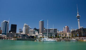
Auckland Domain
The Auckland Domain is probably best known for the annual CocaCola Christmas in the Park extravaganza. This 75 hectare park is Auckland’s oldest and has been developed around an extinct volcano. There are duck ponds, sportsfields and the Auckland War Memorial Museum is located right in the middle!
read more- Location: 20 Park Road, 21 Domain Drive, George Street, Titoki Street and 72 – 80 Stanley Street, Parnell
-

Peel Forest Park Scenic Reserve
Peel Forest is located in the foothills of the Southern Alps; turn off SH 72, about 12 km north of Geraldine. Once at the forest, a wide variety of short and long tracks extend into the park but for littlies choose the beginning of the Big Tree Walk, which is suitable for prams and wheelchairs.Explore the largest reserve in the Geraldine area on a variety of tracks. Base yourself at the campsite and take your time.
read more- Location: Peel Forest is accessed from Rangitata Gorge Road and from Blandswood Road.
-

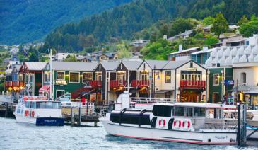
Frankton Arm Walk - Queenstown
Follow Park Street, alongside Queenstown Gardens, down to the lake and Peninsula Street. The Walk begins at the end of this road. A very pleasant walk alongside the lake with views across the Frankton Arm to Kelvin Heights. You come out at Frankton Marina and can continue through to the main beach at Frankton.
read more- Location: Queenstown - end of Park Street, Queenstown
-

Millennium Walkway - Wanaka
Gentle ups and downs as you follow the lakeshore, finishing at a secluded bay – ideal picnic /swim spot.
read more- Location: Wanaka - Take the Mount Aspiring Road out of town towards Glendhu Bay. The track is well signed on the right hand side, just a few kilometres along this road.
North Island
South Island

- Central Otago
- Auckland
- Bay of Plenty
- Christchurch
- Dunedin
- Coromandel
- Gisborne
- Fiordland
- Hawkes Bay
- Marlborough Sounds
- Manawatu
- Nelson & Golden Bay
- Northland
- North Canterbury
- Queenstown
- Rotorua
- South Canterbury
- Taranaki
- Southland
- Taupo
- Wanaka
- Waikato
- Wellington
- West Coast
- Whangarei
- Bay of Islands
- Tauranga
- Gisborne
- Hamilton
- Napier
- Kapiti
- Palmerston North
- Whanganui
- New Plymouth
- Arrowtown
- Te Anau
- Akaroa
- Ashburton
- Hanmer
- Kaikoura
- Methven
- Mt Cook
- Oamaru
- Tekapo
- Timaru
- Abel Tasman
- Motueka
- Nelson Lakes
- Blenheim
- Picton
- Catlins
- Gore
- Stewart Island
- Central Plateau
- Invercargill
- Cromwell
- Greymouth
- Hokitika
- Westport
- Glenorchy
Our favourite destinations…